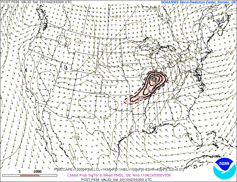
Much like Tuesday, we will have a surface low tracking through the northern part of the state. Areas south of the warm front will become modestly to moderately unstable in the presence of strong vertical shear. Thunderstorms may be around for much of the day but the main show will take shape to our west during the afternoon. Storms should start out as discrete supercells before congealing into more of a linear mode during the evening. Given strong/relatively unidirectional wind fields aloft, damaging winds should be the main threat with this activity in our area, although considerable turning in the lowest 1 km of the atmosphere suggests a possibility of some tornadoes.
Instability parameters are not quite as impressive as Tuesday and as a result, I would expect the overall magnitude of the severe weather event to be a little less impressive. That being said, this may still be a fairly significant event especially in the southern 2/3rds of the state. The SREF has been consistent in showing an area of maxed out probabilities in Illinois with high probabilities spreading into Indiana.
No comments:
Post a Comment